LOG IN
REGISTER
Forums
Technical Discussion
Stock XJ Cherokee Tech. All XJ Non-modified/stock questions go here
Modified XJ Cherokee Tech
MJ Comanche Tech. Stock & Modified.
KL Cherokee Tech
Modified Grand Cherokee Tech. All ZJ,WJ & WK aftermarket tech goes here
Stock Grand Cherokee Tech. All ZJ/WJ/WK Non-modified/stock questions go here!
Fabrication & builders section.
Jeep Builds
Aftermarket electrical systems
Jeep JK Model Discussion
Other Vehicles. Other Jeep models & cars and trucks of other makes
Technical Write-Up/How To Section
General
Introductions
Cherokee Chat
Cherokee of the Month
Wheeling Neighborhoods
Pacific Northwest
Pacific Southwest
Northern Rockies
Four Corners
Midwest
South Central
Great Lakes
Southeast
North Atlantic
Mid Atlantic
International
Wheeling Discussion
Trail Reports
Land Use Forum
Buy, Sell, Trade
Non-Cherokee Parts
Vendor Showcase
Vehicles
Axles/Tires/Wheels
Engines/Tranny/T-Case
Suspension/Steering
Accessories
Part Outs
Miscellaneous
Wanted
CF Announcements & Suggestions
Announcements
CF Suggestions & Questions
Test Section
Marketplace
Vendor Directory
Become a Vendor
Member Marketplace
Vendor Marketplace
New Posts
Tools
Car Payment Calculator
Tire Rim Calculator
Vin Decoder
Recalls
Technical Service Bulletins (TSBs)
Members List
Live Feed
How-Tos
Gallery
View Dark Mode
Please register or login to enable Dark Mode.
Log In
Register
Threads
Google
Threads
Posts
Advanced
Dark Mode
Please register or login to enable Dark Mode.
Log In
Forgot your Password?
By logging into your account, you agree to our
Terms of Use
and
Privacy Policy
, and to the use of cookies as described therein.
or
Login with Google
Login with Facebook
Recent
Commented
Albums
My Pictures
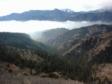
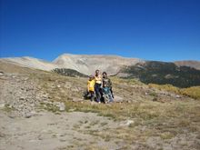
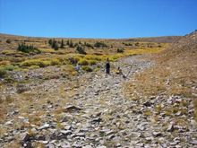
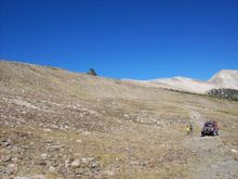
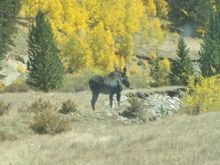
Rocky Mountains in Colorado
radio flyer
May 9, 2009
69
3
Description:
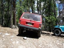
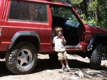
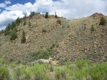
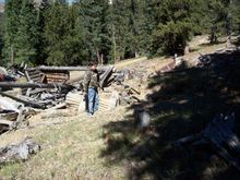
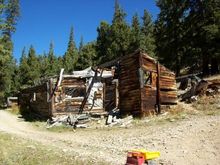
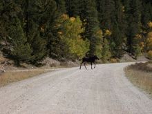
Frenchman Creek Buena Vista Co.- Mt. Herman rd. Co. Springs CO.- Mt. Bross, Sheep Mt. ,Breakneck Pass, Browns Pass Pike National Forest, outside Fairplay Co.
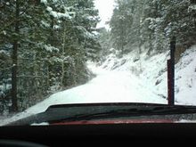
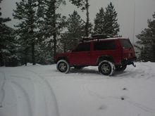
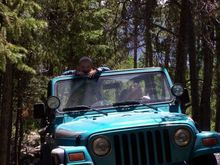
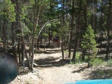
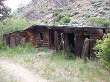
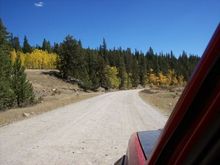
St. Elmo Co. Tin Cup Pass, Alpine Loop, Mount Antero outside Buena Vista Co.
Read more ยป
Sort:
Default
Default
Most Recent
jan. 09 Rampart range rd.
1
2009/05/09 20:01:28
radio flye
jan. 09 Rampart range rd.
0
2009/05/09 20:01:28
radio flye
12/2008 Steering for daddy
0
2009/05/09 20:01:28
radio flye
10/2008 Mt Herman rd 39.068676,-104.940419 Google maps
0
2009/05/09 20:01:28
radio flye
10/2008 Mt Herman rd.
0
2009/05/09 20:01:28
radio flye
Break 10,000 ft. on way up Frenchman Creek, North West of Buena Vista Co. 38.948233,-106.241401 Google maps
0
2010/07/10 07:29:35
radio flye
My mother in law and her TJ (Skin crawl)
0
2010/07/10 07:29:35
radio flye
Break on the way up to enjoy the Views along this ridge
0
2010/07/10 07:29:35
radio flye
Monkey Boy to Grand ma - Over
0
2010/07/10 07:29:35
radio flye
Checkin out the jeep for Daddy
0
2010/07/10 07:37:55
radio flye
Gotta love a soft top
0
2010/07/10 07:37:55
radio flye
Eat my dust
0
2010/07/10 07:37:55
radio flye
My youngest playing with his cousin Madison, back at the camp
0
2010/07/10 07:37:55
radio flye
Mountain goat on a trail NW of Granite Co.
0
2010/07/10 07:45:06
radio flye
More goats
0
2010/07/10 07:45:06
radio flye
They blend in pretty good!!
0
2010/07/10 07:45:06
radio flye
Old cabin on trail North of Granite Co
0
2010/07/10 07:45:06
radio flye
Fixer upper North of Granite Co. on Co Route 27A
0
2010/07/10 07:45:06
radio flye
11,856 ft.
0
2010/09/20 08:58:57
radio flye
Momma and monkey boy striking out on their own towards Sheep Mt.
0
2010/09/20 08:58:57
radio flye
jeepin 010
0
2010/09/20 08:58:57
radio flye
Break time at 11,700 ft. 39.177316,-106.133122 Google maps Sheep Mountain in the background at 12,818 ft.
0
2010/09/20 08:58:57
radio flye
jeepin 008
0
2010/09/20 08:58:57
radio flye
Tyler and John hunting Tommy Knockers
0
2010/09/20 09:01:21
radio flye
jeepin 006
0
2010/09/20 09:01:21
radio flye
jeepin 005
0
2010/09/20 09:01:21
radio flye
jeepin 004
0
2010/09/20 09:01:21
radio flye
jeepin 003
0
2010/09/20 09:01:21
radio flye
jeepin 002
0
2010/09/20 09:03:10
radio flye
old mine and cabin on Sheep Ridge north of Breakneck Pass @ 11,200 ft. 39.165954,-106.093104 Google maps
0
2010/09/20 09:03:10
radio flye
jeepin 015
0
2010/09/20 09:03:10
radio flye
jeepin 014
0
2010/09/20 09:03:10
radio flye
jeepin 013
0
2010/09/20 09:03:10
radio flye
Moose on the forest road west of Alma Co.
0
2010/09/20 09:04:05
radio flye
jeepin 011
0
2010/09/20 09:04:05
radio flye
jeepin 010
0
2010/09/20 09:04:05
radio flye
jeepin 008
0
2010/09/20 09:04:05
radio flye
An arrista near parris mill, it was used to grind gold bearing ore. 39.294338 -106.104940 Google maps look for green arrow
0
2010/09/20 09:05:21
radio flye
Mt. Silverheels east from Mt. Bross
0
2010/09/20 09:05:21
radio flye
My oldest Tyler and his friend John, puttin up with monkey boy!! The Dolly Varden Mine is just above and behind them.
0
2010/09/20 09:05:21
radio flye
First
Page
1 of 2
Last
Go To
Page
1
2
1 of 2
Go To
GO
Go to page
of 2
pages
1
2