


Hogsback and Ishi Roads

Thread Starter
CF Veteran
Joined: Aug 2008
Posts: 6,588
Likes: 495
From: Chico, CA
Year: 1986
Model: Cherokee
Engine: 4.3L with headers and full 3" exhaust system
 Hogsback and Ishi Roads
I couldn't seem to get anyone to go with me up Hogsback, so I went by myself. Hogsback Rd starts about 1/2 mi east of Red Bluff on Hwy 36. From Hwy 36, turn north and just follow it. The pavement soon runs out.

Stopped here and took the tires down to 15# The stone fence is a common thing around here on what we call "lava cap" The soil is very thin and you can't dig a hole in it, so you build a stone fence. Most of these go back 150 years or more and were built by Chinese, Irish and Indians. The road climbs a good thousand feet in short order. Here is the valley below.

It doesn't show up well, but this is Many Springs Plain. The water follows the stone lava cap and shows up in many places, and of course in the road. The whole road is filled with these dried puddles that are about 8" deep. Not a big deal, unless you are traveling at speed.
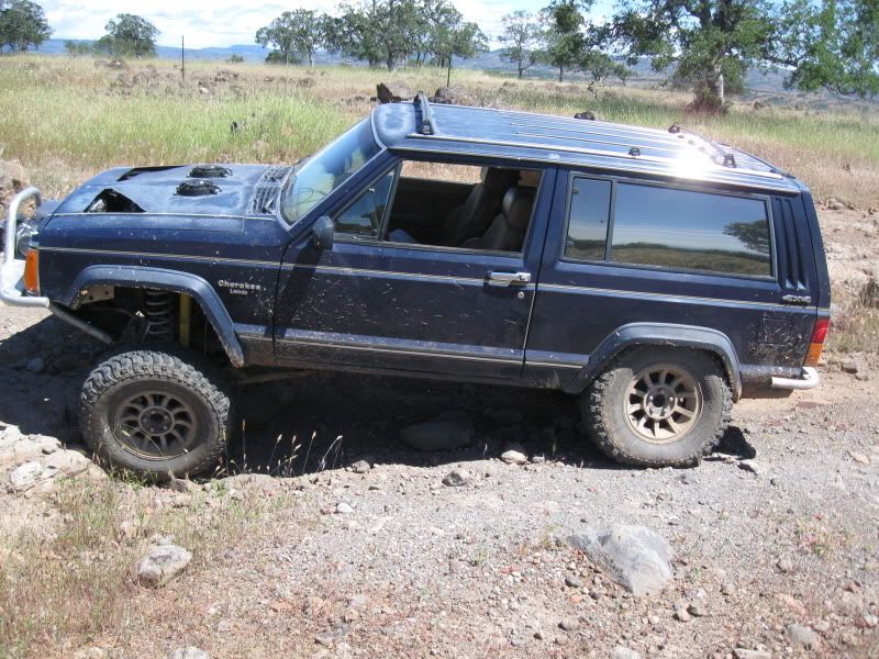
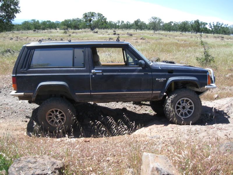
There are a few of these types of things, with bypasses. But who wants bypasses? I stopped to check out the flex on the new rear springs. Here is the other side.

I had to stop for a Kodak Moment. Nice view of Mt Lassen, the source of all this lava.
That concludes Hogsback Rd. About 22 mi of the same stuff shown in the pics. At the top, there are several roads that take off from it. Some are considered Jeep roads by the Forest Service. For the most part, they are just rough roads that are not maintained. I went down Ishi Road. Ishi is a famous name around here. He was the last wild indian in the US. Here is his story. Very tragic really. http://www.mohicanpress.com/mo08019.html
There are two campgrounds and three "slab crossings" on creeks.

There are numerous views of some impressive lava formations


As well as some funny caterpillars

I was ready to head up and out from the second campground and thought I would not really see any technical wheeling when I came to the first obstacle.

Up to this point I had not used any gears in the Atlas lower than 2.7:1 This one wasn't too bad, did not even spin a tire. There were a couple more like this. Then there was this one.

It is worse than it looks, had to make three tries before I found the right line. Notice the asphalt? You usta could drive a car down there.
After that there was no place to turn around
The next obstacle was one of those that required lockers, which I don't have yet, well at least not in the Jeep. I had to stretch some cable on this one.
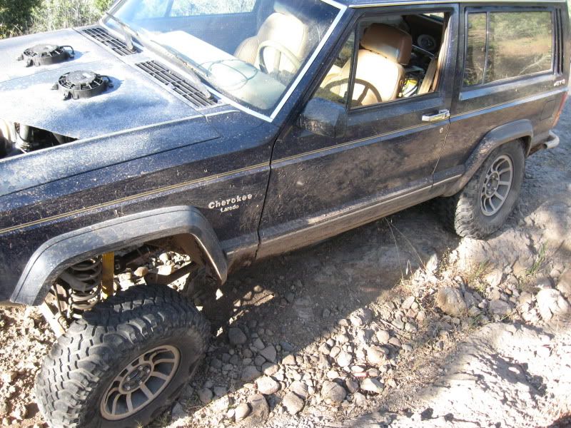
And this one
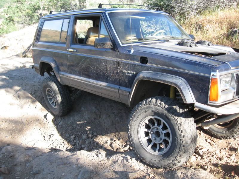
Left a few miles of rubber on the rocks, but got away clean in the smoke screen

At this point, I lost a front brake line and almost all my brakes, which made things real interesting on a steep hill. But deep gears in the Atlas saved me along with my new disk brake on the back of it. Once I got going I didn't stop for any more Kodak Moments due to the brake issue. I continued on and came out on Hogsback Rd again several miles from where I had left it. The fast way home would have been to go back down it. But since I had essentially no brakes, I opted to go home the back way and drop down into Chico from the town of Cohassett. It took me four hours to do that. I got back at 11:30 and clocked 105 mi of off highway driving today.
Stopped here and took the tires down to 15# The stone fence is a common thing around here on what we call "lava cap" The soil is very thin and you can't dig a hole in it, so you build a stone fence. Most of these go back 150 years or more and were built by Chinese, Irish and Indians. The road climbs a good thousand feet in short order. Here is the valley below.
It doesn't show up well, but this is Many Springs Plain. The water follows the stone lava cap and shows up in many places, and of course in the road. The whole road is filled with these dried puddles that are about 8" deep. Not a big deal, unless you are traveling at speed.
There are a few of these types of things, with bypasses. But who wants bypasses? I stopped to check out the flex on the new rear springs. Here is the other side.
I had to stop for a Kodak Moment. Nice view of Mt Lassen, the source of all this lava.
That concludes Hogsback Rd. About 22 mi of the same stuff shown in the pics. At the top, there are several roads that take off from it. Some are considered Jeep roads by the Forest Service. For the most part, they are just rough roads that are not maintained. I went down Ishi Road. Ishi is a famous name around here. He was the last wild indian in the US. Here is his story. Very tragic really. http://www.mohicanpress.com/mo08019.html
There are two campgrounds and three "slab crossings" on creeks.
There are numerous views of some impressive lava formations
As well as some funny caterpillars
I was ready to head up and out from the second campground and thought I would not really see any technical wheeling when I came to the first obstacle.
Up to this point I had not used any gears in the Atlas lower than 2.7:1 This one wasn't too bad, did not even spin a tire. There were a couple more like this. Then there was this one.
It is worse than it looks, had to make three tries before I found the right line. Notice the asphalt? You usta could drive a car down there.
After that there was no place to turn around
The next obstacle was one of those that required lockers, which I don't have yet, well at least not in the Jeep. I had to stretch some cable on this one.
And this one
Left a few miles of rubber on the rocks, but got away clean in the smoke screen
At this point, I lost a front brake line and almost all my brakes, which made things real interesting on a steep hill. But deep gears in the Atlas saved me along with my new disk brake on the back of it. Once I got going I didn't stop for any more Kodak Moments due to the brake issue. I continued on and came out on Hogsback Rd again several miles from where I had left it. The fast way home would have been to go back down it. But since I had essentially no brakes, I opted to go home the back way and drop down into Chico from the town of Cohassett. It took me four hours to do that. I got back at 11:30 and clocked 105 mi of off highway driving today.
Thread Starter
CF Veteran
Joined: Aug 2008
Posts: 6,588
Likes: 495
From: Chico, CA
Year: 1986
Model: Cherokee
Engine: 4.3L with headers and full 3" exhaust system
Quick update
Just a quick update. The brake line appears to have been rubbed by the tire. I was not aware of this happening. I have replacements coming. However, I am not a fan of those 22" brake lines hanging out in space. When I redo the long arms suspension and go to three link, I am going to address this so it doesn't happen again. Also, just to give you a sense of the trip even on forest service roads which were rough in themselves with lots of whoops and mud holes, I lost the pin out of my clevis after I got off the Ishi road. It apparently vibrated out.


Registered Users
Joined: Dec 2009
Posts: 1,859
Likes: 0
From: Everett, WA
Year: 1992
Model: Cherokee
Engine: 4.0
Thread Starter
CF Veteran
Joined: Aug 2008
Posts: 6,588
Likes: 495
From: Chico, CA
Year: 1986
Model: Cherokee
Engine: 4.3L with headers and full 3" exhaust system
First off, those fans are for oil coolers that work independent of the radiator fans.
This is one of those times where my friends information was not accurate. None of the really difficult spots were supposed to be in this area. Once it happened it was too late to back down. Which is why I have a winch and lots of recovery gear.
This is one of those times where my friends information was not accurate. None of the really difficult spots were supposed to be in this area. Once it happened it was too late to back down. Which is why I have a winch and lots of recovery gear.

Thread
Thread Starter
Forum
Replies
Last Post
InitialForce
Modified XJ Cherokee Tech
9
Jul 5, 2022 12:17 AM
Freakn
Stock XJ Cherokee Tech. All XJ Non-modified/stock questions go here
52
Oct 4, 2015 06:34 AM
Currently Active Users Viewing This Thread: 1 (0 members and 1 guests)