3 wks, 13 trails; Part 3 Shafer Trail 3/27/09
 05-18-2009, 11:12 PM
#1
Seasoned Member
Thread Starter
Join Date: Dec 2008
Location: 25 Miles From Moab!
Posts: 348
Likes: 0
Received 4 Likes
on
4 Posts
Year: 1998
Model: Cherokee
Engine: 4.0
Trail #3 was another scenic trip with my Uncle. This can’t really be called a trail, it’s more of a road. The first half is Potash Road which we did most of in a mini van about 6 years ago... the rental company's don't like us much lol And the second part is called Shafer Trail. Its graded and smooth most of the way but not for someone who is afraid of heights. I haven't seen many pics of Shafer online so I figured I would throw some up. It blows my mind anyone would build a road up this... crazy miners!
Jug Handle Arch off of Route 279

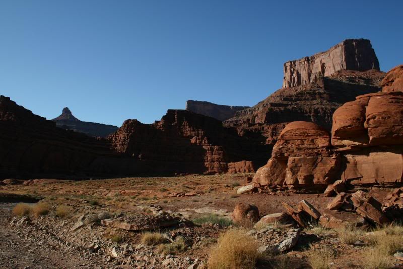
Looking across towards Hurrah Pass... it’s hard to believe there is a road up that!
Just to the right of Anticline Overlook from Potash RD

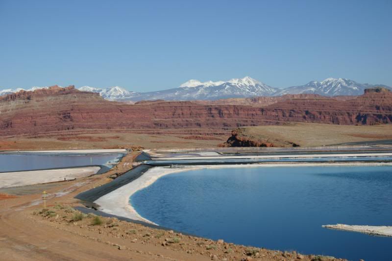
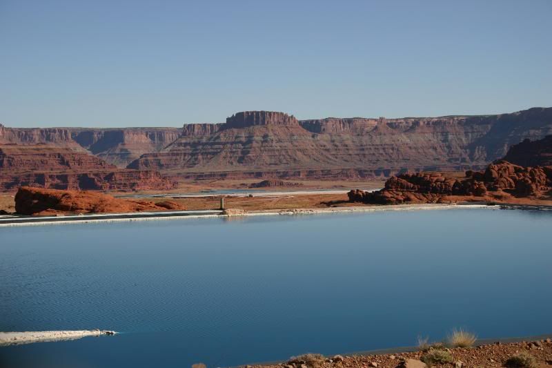
The Potash evaporation ponds

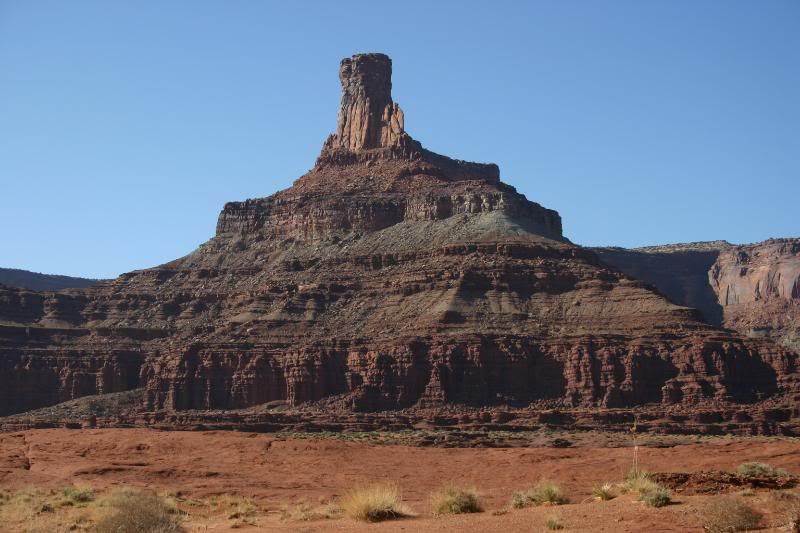
Chimney Rock looks so different from this side
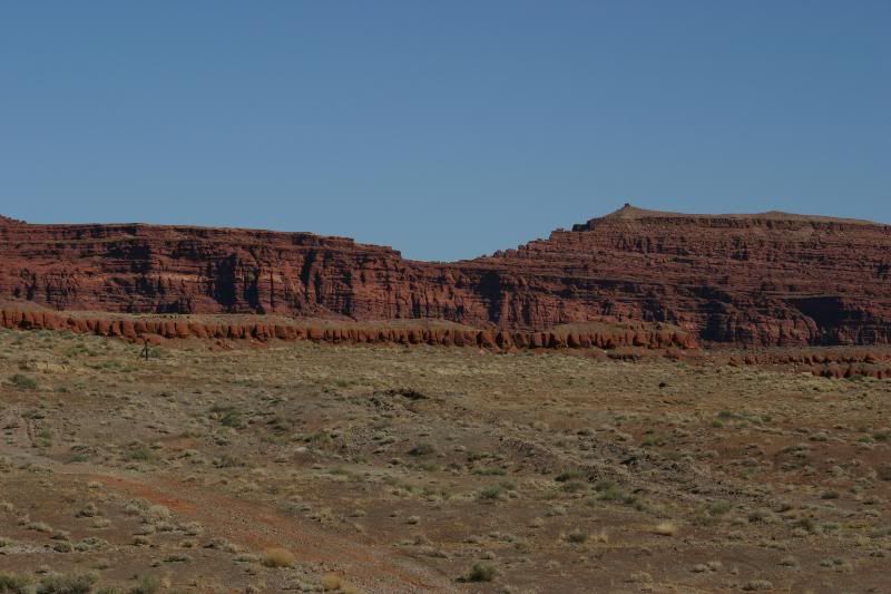
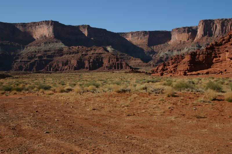
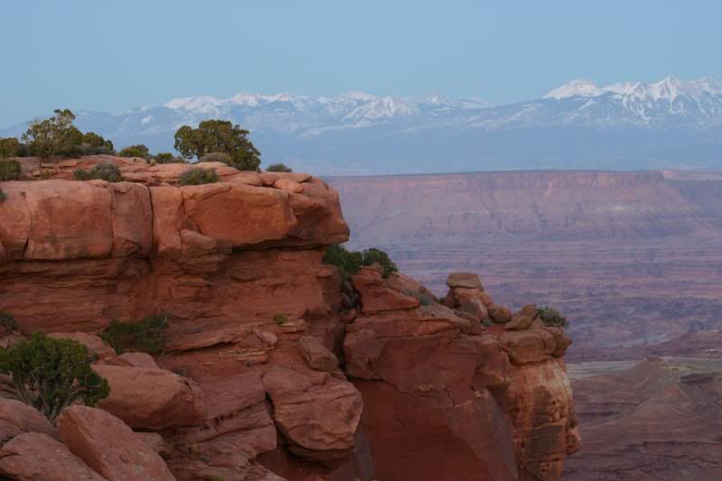
Canyon Walls
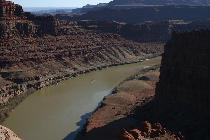
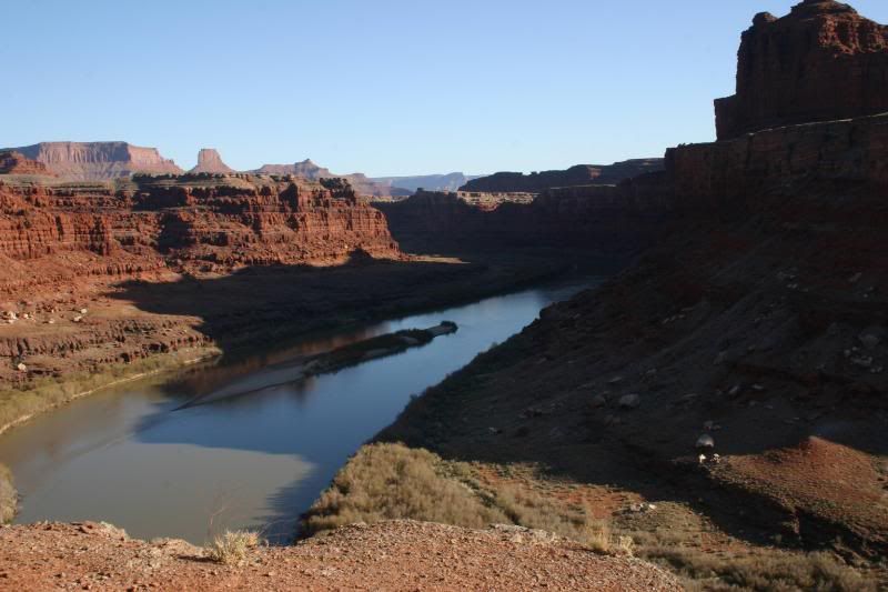
Looking down on the Colorado. You can see Chicken Corners on the right side of this pic.
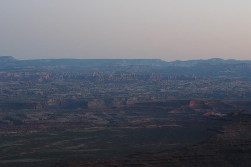
Looking downstream into the heart of Canyonlands
Chimney Rock and river
Zoomed in shot of Chicken Corners
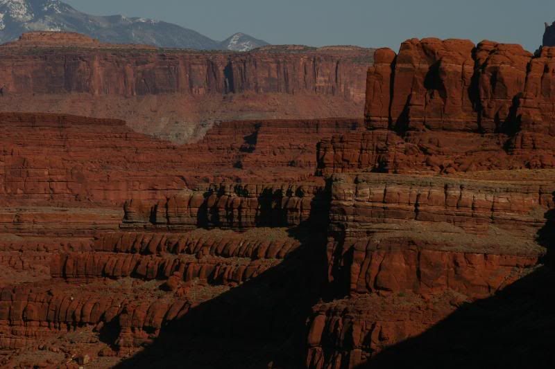
Random mesa's off of Potash RD
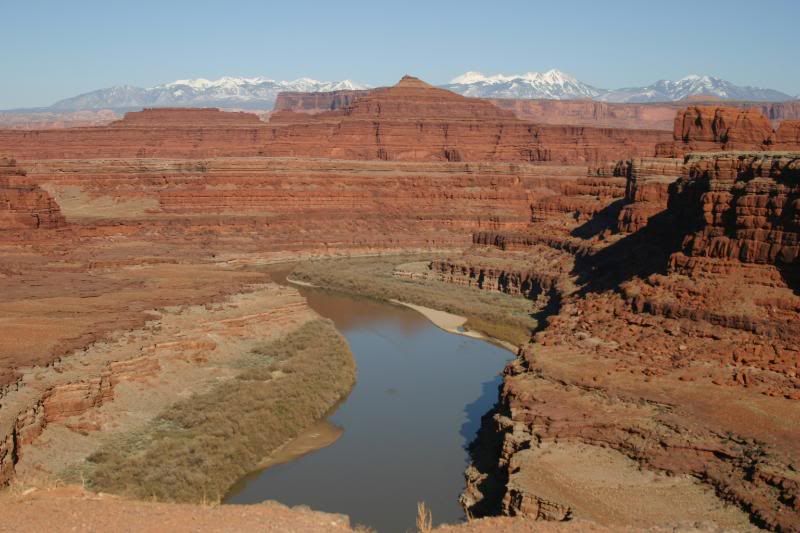
Another shot down on the river along one of its many goose necks

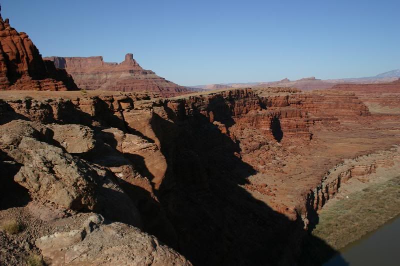
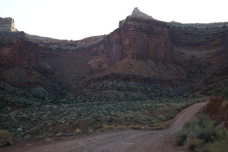
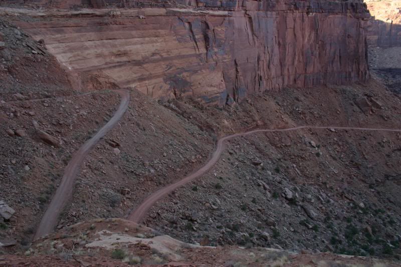
Right after you take a right onto Shafer Trail you head towards this canyon wall. Hmm can you figure out where the road goes up?
Cool Lighting

If you guessed that dirt fan on the left you where right... starting up the switchbacks

Looking back down into the valley

Climbing Higher

Jug Handle Arch off of Route 279
Looking across towards Hurrah Pass... it’s hard to believe there is a road up that!
Just to the right of Anticline Overlook from Potash RD
The Potash evaporation ponds
Chimney Rock looks so different from this side
Canyon Walls
Looking down on the Colorado. You can see Chicken Corners on the right side of this pic.
Looking downstream into the heart of Canyonlands
Chimney Rock and river
Zoomed in shot of Chicken Corners
Random mesa's off of Potash RD
Another shot down on the river along one of its many goose necks
Right after you take a right onto Shafer Trail you head towards this canyon wall. Hmm can you figure out where the road goes up?
Cool Lighting
If you guessed that dirt fan on the left you where right... starting up the switchbacks
Looking back down into the valley
Climbing Higher
 05-18-2009, 11:13 PM
#2
Seasoned Member
Thread Starter
Join Date: Dec 2008
Location: 25 Miles From Moab!
Posts: 348
Likes: 0
Received 4 Likes
on
4 Posts
Year: 1998
Model: Cherokee
Engine: 4.0
Nearing the top of the switchbacks


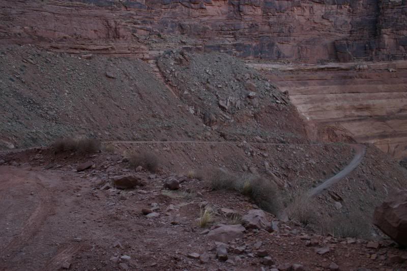
You continue along the ledge in the top of this picture and around the corner on the right side of the pic.

Some great late afternoon pics looking back down into the valley
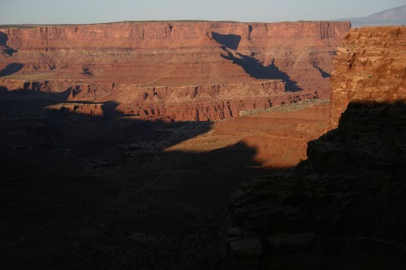
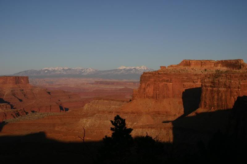
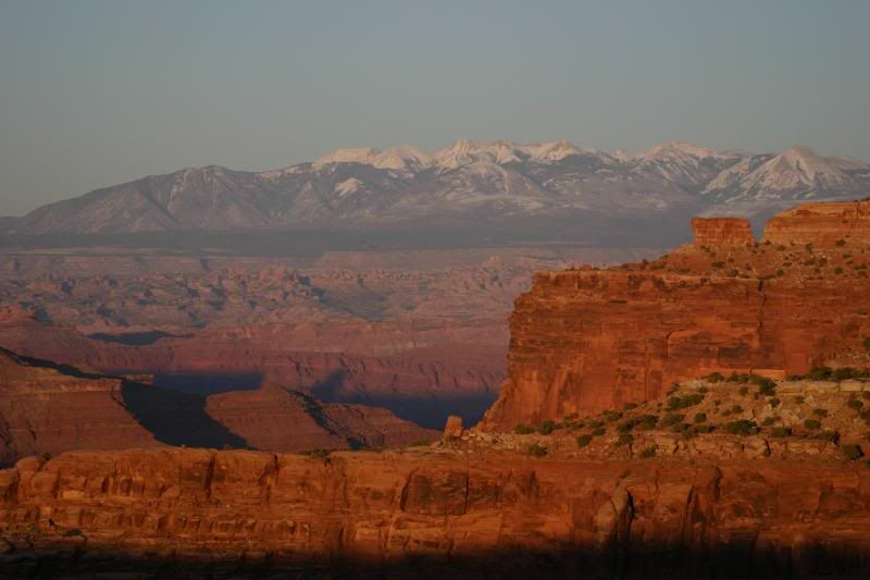
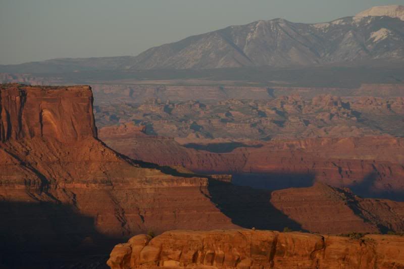
Once you get to the top of Shafer you come out on Route 313 which is the main road that runs through the park. These are a few pics looking down on the trail from a viewpoint along 313.


A few more near sunset pics
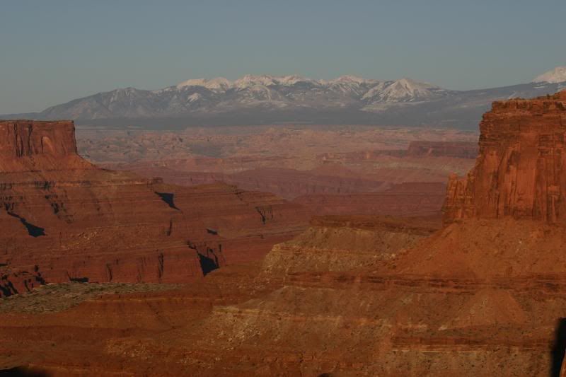
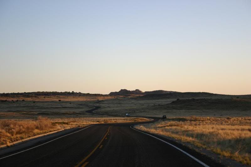
We continued on to Grand View Point and watched the sunset.
Route 313
Sunset
Looking towards the Needles District of Canyonlands
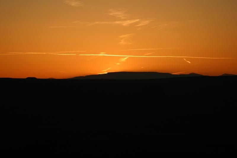
After Sunset Glow
Almost Dark

That's all till #4


Thread
Thread Starter
Forum
Replies
Last Post
xjwolfman
Stock XJ Cherokee Tech. All XJ Non-modified/stock questions go here
8
08-26-2020 12:59 PM
Docruiz
Stock Grand Cherokee Tech. All ZJ/WJ/WK Non-modified/stock questions go here!
0
09-02-2015 07:54 PM
Currently Active Users Viewing This Thread: 1 (0 members and 1 guests)